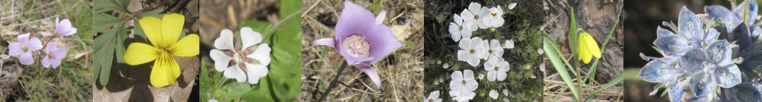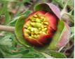
NPSO 2015 Annual Meeting
Field Trips
 Mt Hood from the Weldon Wagon Trail. Photo by Don Hardin. |
This listing will be updated as needed to reflect changes required by, for example, snow levels, road conditions, bloom times and trip leader advance work. More photos and documents may be added over the next weeks. Please send any corrections to webmaster@npsoregon.org.
The area within 50 miles in any direction from Hood River offers a variety of ecosystems, varying by elevation, by distance east of the Cascades and by whether the terrain faces predominantly north or south. We’ve tried to select destinations that will be new to most NPSO members, that will show off the botanical diversity of the area and that will offer hikes of varying degrees of difficulty.
We strongly encourage the use of hiking poles, not only to protect hikers from falls, but also to protect unstable substrates and associated flora from damage caused by foot traffic when traveling off-trail. Please help us protect these fragile environments.
The major objective hazards for this set of outings, apart from possibly inhospitable weather and unstable substrates, are poison oak, rattlesnakes, and ticks.. Generally, outings above about 3000’ elev. present lower risk of these particular nuisances. Wearing a hat, a long – sleeved shirt and long pants tucked into your socks are easy prophylactics. Fortunately, rattlesnakes are sensitive to foot-fall-induced ground vibrations, such that a thundering herd of botanists provides “scram” signals. Hiking poles offer great backup rattler protection. Your trip leader is the final authority on these hazards.
Reduced physical mobility is an unfortunate fact of life for some NPSOers. We have tried to provide several destinations where hikers with varying degrees of mobility can enjoy native plants in their wild settings. Short-distance destinations sometimes serve as jumping-off points for more ambitious trips, so that high-mobility and lower-mobility participants can share transportation and sociability. Implicit in this arrangement is the weather-dependent possibility that lower-mobility folks may hang around a trailhead waiting for other hikers to return. Think about bringing folding chairs, reading, sketching materials or the like to help pass the time should you want a less vigorous outing.
Trips appropriate for lower-mobility participants are marked with ##. If you have questions about the suitability of particular trips to your mobility status, please email annualmeeting@npsoregon.org. Otherwise, use the distance and elevation-change estimates to gauge the suitability of each trip.
Links to some maps are provided in the descriptions below, and we shall try to make sure that maps for the Hood River and Mt Adams Ranger Districts are available locally. (See also the Resources section of this website.) Driving directions will be provided for your field trip(s) at Check-in. A Washington Discover Pass is required for most state public lands in Washington. To learn about the pass and to obtain one in advance, go to http://discoverpass.wa.gov/FAQ.aspx.
In the following descriptions, RT means “round trip”; SR = State Route; FR = Forest Road; MP = milepost; OSP = Oregon State Parks; WA DNR = Washington Department of Natural Resources; DFW = Department of Fish & Wildlife; BWHR Inn is the Best Western Plus Hood River Inn. All trips will leave at the stated time, without waiting for late comers. The number of hikers per destination is limited. In keeping with NPSO policy, dogs will not be allowed on field trips. You must be registered for the meeting to attend a field trip.
NOTE: Most of the Friday and Sunday field trips have filled. We have added a new field trip to each day; see 29-8 and 31-8 for the new outings.
We believe that we have enough slots for everyone to go on a Saturday trip. Notifications of field trip assignments will go out as soon as possible. We also plan to provide a list of possible self-guided trips at the meeting.
 Orobanche uniflora, Rattlesnake Falls, WA. Photo by Carolyn Wright. |
FRIDAY AFTERNOON HIKES – return by 4:30 p.m.
Many of the/ Friday field trips have filled up. We have added a new outing - see 29-8 below.For the first two hikes (#29-1 & 29-2), gather at the BWHR Inn parking lot at 11:30 a.m., leave at noon. For all remaining trips, gather at BWHR Inn at 12:30 pm and leave at 1:00 pm.
FULL! ##29-1 RATTLESNAKE FALLS, WA. Leader: Will Bloch. EASY Hike to falls is ~1.5 mi out-and-back, no elevation gain. This small patch of WA DNR trust land, potentially open to grazing and logging, offers two examples of charismatic, relatively scarce species in exceptional abundance at the edge of their geographic range: Brown’s peony (Paeonia brownii) and Barrett’s penstemon (Penstemon barrettiae). The area contains many other PNW natives, for example Hydrophyllum capitatum var. thompsonii, Lupinus polyphyllus, Amelanchier alnifolia, Claytonia parviflora and several Lomatium ssp.
Not to be neglected is the scenery at Rattlesnake Falls: a dramatic 92’ plunge and a deep rocky canyon downstream from the falls. Across the creek from the north-bank access route, a short walk west leads to a scenic overlook of the broad lower Rattlesnake basin. After the swallows return, the air over the falls and canyon may be full of swooping, diving, strafing birds that nest in the cliffs.
The trailhead lies at 1600’ and is accessed via WA DNR roads between Rattlesnake Creek and the BZ to Glenwood Highway. Drive: 42 miles RT, ~ 8 miles RT on well-maintained gravel road; approx 2 hr RT.
Plant list: http://science.halleyhosting.com/nature/bloomtime/egorge/11/29.htm"
For good pictures (and an overly dramatic trip diary), see:http://www.thegorge.com/waterfall-spotlight-rattlesnake-falls
FULL!! 29-2 WELDON WAGON ROAD, WA. Leaders: Jeanne Demorest (WA DFW) & Keyna Bugner (WA DNR). MODERATE. 5.4 mi out-and-back, 1340’ elevation gain/loss on well-maintained trail. The trail climbs gently but steadily for about 2.5 mi through second-growth conifers and then oak savannah before entering oak-conifer woods (White Salmon Oak NRCA). It finally levels out at the edge of a small rural community at the end of Sanborn Rd. The upper half of the trail traverses a very steep meadow richly populated with Balsamorhiza and just about every Lomatium species in the area (at least 8 species), including Lomatium suksdorfii, listed as Sensitive in WA. Other special species include Cypripedium fasciculatum, Lithospermum ruderale, and Viola sheltonii. Look for Corallorhiza sp in the woods near the top of the trail.
The trailhead is at about 600’ elevation on Cemetery Rd., a short branch of Indian Creek Rd., about 0.75 mi east of Husum. Drive: ~18 mi RT, almost entirely on pavement (~ 30 min RT).
For more information about the site:
http://www.dnr.wa.gov/AboutDNR/ManagedLands/Pages/amp_na_white_salmon.aspx
http://trails.gorgefriends.org/trail/weldon-wagon-trail
Plant list:
http://science.halleyhosting.com/nature/bloomtime/lists/wa/klickitat/Weldon Wagon Trail.pdf
 Weldon Wagon Trail, WA. Photo by Carolyn Wright. |
FULL! 29-3 HOOD RIVER MOUNTAIN MEADOW, OR. (Note: NOT Hood River Meadows ski area.) Leader: Heidi Venture. EASY. Variable hike length of 0.5 to 3 mi. From a gate, we'll walk on a utility road about 0.25 mi, then the main trail goes up & down through open meadow north about a mile (view of Mt Adams) and/or south for less than 0.5 mi (spectacular views of Mt Hood and the Hood River Valley).
Some blooms we might find: heart leaf buckwheat – Eriogonum compositum; woods strawberry – Fragaria vesca; cinquefoil -Potentilla sp.; pearhip rose – Rosa woodsii; several vetches including Hood River milk vetch – Astragalus hoodianus; at least two lupines including Columbia Gorge Broad-leaf Lupine - Lupinus latifolius x L. sericeus; desert parsleys including slender-fruited - Lomatium leptocarpum, gray-leaf (yellow form) L. macrocarpum, bare-stem – L. nudicaule; harsh paintbrush - Castilleja hispida; sticky stem penstemon - Penstemon glandulosus; honeysuckle – Lonicera ciliosa; yarrow – Achillea millefolium; Northwest Balsamroot - Balsamorhiza deltoidea (or B. careyana x deltoidea?); Oregon sunshine – Eriophyllum lanatum; white western groundsel – Senecio integerrimus var. ochroleucus; death camas – Toxicoscordion sp.; and bicolor cluster lily – Triteleia grandiflora.
Parking is limited, so we will need to carpool. 12 mi, of which ~ 4 mi potholed gravel, 30 min RT. Please observe and obey all private property signs, and watch for poison oak.
FULL!! 29-4 TOM MCCALL NATURE PRESERVE, OR. Leader: Jude Russell. MODERATE. (~3.5 mi RT, 1070’ gain/loss) This Nature Conservancy preserve is one of the best-known spots in the Gorge for early wildflowers. Less well known is that there are still flowers to be seen later in the season, especially at McCall Point. The trail to McCall Point travels through an oak woodland to the open meadow at the summit, offering great views of the Gorge and beyond. [Note: the trail is being reconstructed this year, but will be open]. Be alert for poison oak and rattlesnakes. It is often windy here. Drive: ~ 25 mi (40 min) RT, all pavement.
For a more detailed description and a map of the hike to McCall point:http://trails.gorgefriends.org/trail/tom-mccall-nature-preserve/
FULL!! ## 29-5 TWIN TUNNELS, Mosier, OR. Leaders: Barbara Robinson & Elizabeth Stanek. EASY – about 4 mi RT. family friendly. restrooms, wheelchair accessible. The Historic Columbia River Highway Trail runs between Mark Hatfield West trailhead SE of Hood River and Mark Hatfield East Trailhead on the western edge of Mosier. It is a mostly level paved trail on the old Scenic Hwy above and paralleling I-84. We will hike from the east trailhead as time allows for views of the River, geological formations, Eighteen Mile Island and remnants of the historic Columbia River Highway. Expect to hike about 2 mi (4 mi RT). We may see heart-leaf buckwheat (Eriogonum compositum), Oregon sunshine (Eriophyllum lanatum), and Barrett’s penstemon (Penstemon barrettiae) along with many other forbs on open hillsides, basalt cliffs, wet seeps, and in dry coniferous forest. Drive: 12 mi (15 min) RT on paved road. OSP parking fee: $5.
http://www.cascaderamblings.com/cascade.php?cascade=1053398159
http://www.oregonstateparks.org/index.cfm?do=parkPage.dsp_parkPage&parkId=113
Plant list: http://science.halleyhosting.com/nature/bloomtime/egorge/14/14.html
##29-6 CONDIT DAM RESTORATION, WHITE SALMON RIVER, WA. Leader: Jeanette Burkhart. EASY Half day, gather at 12:30, leave at 1:00: 1/3 mi. loop on a wood chip footpath (connects with a trail heading downstream for optional further exploration). Join Yakama Nation Fisheries staff on a short, easy loop foot trail through an active restoration project on the site of the former reservoir formed in the White Salmon River by Condit Dam. The dam was removed in 2011, and in fall 2013 & spring 2014, volunteers have planted 7000 plants of 34 native species, from herbaceous perennials to shrubs and trees, in 2.8 acres of formerly submerged sediments. Funded in part by an Ecotrust grant and with the landowner's (PacifiCorp) permission, Yakama Nation Fisheries and Mid-Columbia Fisheries Enhancement Group have supervised this project in riparian and upland areas. Learn about the challenges of re-vegetation after a century of inundation and about the specific goals of this project, which has now engaged over 300 individual volunteers. Drive: 16 mi (25 min) RT, all pavement.
29-8 COLUMBIA HILLS STATE PARK, WA. EASY.Begin with a hike on the park to see what is out in late May.This will be followed by a 1.5 hour, three quarter mile guided “Petroglyph Tour” in an area of the park which is otherwise closed. A park volunteer will be our guide. There are over 100 images - mostly pictographs along the tour route and salvaged petroglyphs which have been placed near the parking area. This outing will return to Hood River by about 5pm.WA Discover Pass required; a one day pass can be self-issued at the park for $10.
 Ranunculus triternatus, Columbia Hills Natural Area Preserve, WA. Photo by Dell Rhodes |
SATURDAY FIELD TRIPS – return by 4:30 at latest
Gather at BWHR Inn parking lot at 8:00 a.m. for 8:30 departure
FULL ## 30-1 BACKROADS OF GOLDENDALE/SARA WU’S PROPERTY, WA : Leader: Sara Wu. EASY. Road trip up the scenic Klickitat River with stops along the way to view Penstemon richardsonii, Lomatium species including L. suksdorfii, and displays of Ceanothus. On Sara’s property, we may see Cypripedium montanum, Pyrolas, Silenes, Lupinus lepidus, and many other forbs. The property’s ponderosa pine and Douglas fir stands were thinned two years ago, so recovery and the health of the forest can be noted. Drive: 45 mi out on pavement except for final 3 mi on a good gravel road. Return can be over Dalles Mountain Road, about 15 mi on well-maintained gravel road with spectacular views and its own floristic displays.
Plant list:http://www.npsoregon.org/2015mtg/goldendale.pdf
FULL 30-2 BACKROADS - THE DALLES TO FIVE MILE BUTTE, OR Leader: Carolyn Wright. EASY. Road & hiking trip to explore the gradients of elevation and moisture that characterize the east slope of the Cascades. Heading out of The Dalles we’ll see plenty of balsamroots and the rich mix of forbs and shrubs associated with scrubby Oregon white oak (Quercus garryana) stands. We’ll pass through a portion of the 2013 Blackburn Fire and see its effects on the oak woodland and lower elevation ponderosa pine and fir forest. Reaching the Mt Hood National Forest we’ll check out the mosaic of habitats on short walks, including an easy hike to the look-out tower on Five Mile Butte (elevation 4450 feet) to see early season flowers. Loop return to Hood River via FR 17 and Hwy 35. Drive: ~ 80 miles RT, mix of pavement and gravel.
FULL! 30-3 CAPE HORN, WA. Leader: Cyndi Soliz, Cape Horn Conservancy. MODERATE. Out-and-back trail, ~ 6 mi RT, 700’ elevation gain/loss (5.25 mi RT to Nancy Russell Overlook). The Cape Horn Trail features gorgeous views, rocky crags, waterfalls, wildflowers and many species of birds. An oak woodland restoration project sponsored by the Cape Horn Conservancy is currently underway at the Nancy Russell overlook, where a large home and barn once stood. There is a showy display of Camassia and Delphinium through May, and a surprising number of wildflowers throughout the season.
EASY option: Hike directly to the Nancy Russell Overlook, 0.75 mi RT, with no elevation gain. An additional 0.75 mi RT takes you to a second Delphinium-rich overlook. Drive: ~72 mi (90 min) RT. When registering, please specify Cape Horn moderate or easy.
Trail map: www.capehorntrail.org
Plant list: http://www.npsoregon.org/2015mtg/capehorn.pdf
 Looking toward the River from heights of Columbia Hills NAP. Photo by Carolyn Wright |
30-4 COLUMBIA HILLS NATURAL AREA PRESERVE, WA. Leader: Keyna Bugner, WA DNR. MODERATE ~5 mi RT, approx 500’ elevation gain/loss with some cross-country travel on steep slopes. A chance to drive through the locked gate and up the hill before starting to hike! The upper elevations of the preserve are full of flowers in late May and we'll have a chance to sample a variety of habitats and enjoy their associated flowers. Part of the hike will be along the road and part will be off trail – trekking poles advised. Expect to see Astragalus reventiformis, Balsamorhiza, Castilleja hispida, Chaenactis douglasii, Delphinium nuttallianum, Eriogonum spp, Frasera albicaulis, Lewisia rediviva, Lomatium spp, Lupinus spp., Penstemon spp, and much more. At ~ 3000' elevation, the ridgeline offers wonderful bonus views of the Cascade Mountains ranging from Three Sisters (on a very clear day) north to Mt Rainier and Goat Rocks, plus views of the Columbia River and surrounding area. Drive: 70 mi RT (15 mi gravel), 90 min RT. WA Discover Pass required – can be self-issued at a park trailhead nearby.
A plant list and more information about the preserve can be found at: http://www.dnr.wa.gov/AboutDNR/ManagedLands/Pages/amp_na_columbia_hills.aspx
FULL 30-5 CONBOY WILDLIFE REFUGE/WILLARD SPRINGS TRAIL, WA. Leader: Don Hardin. EASY. The Willard Springs Foot Trail is a 3.8-mi loop along the edge of an open marsh and into pines. Beginning at the refuge headquarters, it parallels the west shore of the old Conboy Lake lakebed, with views across the lakebed and north to 12,000’+ Mount Adams. The trail is mostly flat with a couple of gentle grades on the return. A part of the Mid-Columbia National Wildlife Refuge Complex, the preserve is managed primarily for the preservation of birds (e.g. Sandhill Cranes, of which there are more than two dozen nesting pairs at Conboy) and wildlife (e.g. the rare Oregon Spotted Frog, Rocky Mt Elk, Western Gray Squirrel). The different habitats along the trail provide a wide variety of wildflower shows, including several Lupinus (lupines), Potentilla (cinquefoils), Lotus (deer-vetches), Corallorhiza (woodland orchids) and Paeonia brownii (Brown’s peony). Drive: ~80 mi RT (1.5 hr) almost entirely on paved road.
Descriptive Sites:
http://www.fws.gov/refuge/Conboy_Lake/about.html
http://www.stateparks.com/conboy_lake_national_wildlife_refuge_in_washington.html
Plant list: http://science.halleyhosting.com/nature/bloomtime/cascade/wa/2011/1.html
30-6 CONDIT DAM RESTORATION. This field trip has been moved to Friday afternoon, trip # 29-6
 Deschutes River. Photo by Carolyn Wright |
30-7 DESCHUTES RIVER, OR. Leader: Nancy Allen. MODERATE. A 5-mi hike beginning along a terrace above the Deschutes River. There are small ups and downs as you parallel the river. After one mile we will climb 50 ft to join the Ferry Springs Trail, which climbs approximately 400 ft in 0.75 mi to a shallow, slippery crossing of the spring outflow. It then runs along the side of the hill and gradually descends to the old railroad bed, where we will drop down to the Blackberry Trail at river level and return to the main trailhead. Flowers we may see at this time of year include: Balsamorhiza - balsamroot, Eriogonum - buckwheat, Crepis - hawksbeard, Achillea - yarrow, Erigeron - fleabane, Lomatium - desert parsley, Phlox, Lupinus – lupine, and Lithophragma - prairie star. Drive: ~ 70 mi. RT (1.5 hr RT) on highway. Oregon State Park fee: $5.
http://trails.gorgefriends.org/trail/ferry-springs-loop
Plant list: http://science.halleyhosting.com/nature/bloomtime/egorge/05/15.htm
 Grassy Knoll. Photo by Paul Slichter |
30-8 GRASSY KNOLL, SOUTH CASCADES, WA. Leader: Susan Saul. DIFFICULT (1000 ft elevation gain/loss in 4.5 mi RT) or ## EASY option (see below). Hike a rolling ridge through wildflower meadows and conifer woodlands to stunning views of Mount Adams, Mount Hood and the Columbia River at a former fire lookout site. The amazingly diverse and abundant wildflower community in the meadow at the trailhead is accessible for those with limited mobility (EASY option ##). Beyond the meadow, the trail climbs steeply through Douglas-fir (Pseudotsuga menziesii) woods where Anemone deltoidea, Maianthemum stellatum, Achlys triphylla and Xerophyllum tenax bloom. While some trees are five feet thick, the strong winds from the Columbia River Gorge keep them short and some have the flagged look that shows which way the wind blows.The well-maintained trail then levels off along a cliff-top rim with views of Mount Adams across the Big Lava Bed and an impressive display of Penstemon rupicola. Rolling up & down through increasingly large meadows, the trail reaches the broad summit of Grassy Knoll. Along the way, see a bald filled with Allium crenulatum.
We will be on the crest of the Cascade Range -- this trail was formerly a segment of the Pacific Crest Trail -- with both westside and eastside flower species represented. There are not many botanical surprises but an interesting mix of species including Synthyris missurica, Pteryxia terebinthina, Delphinium nuttallianum, Calochortus subalpinus, Balsamorhiza deltoidea, Phlox diffusa, Thlaspi montanum, Ipomopsis aggregata, and Lomatium dissectum.
Foundation piers mark the lookout site. To the south, Mount Hood rises above Nick Eaton Ridge on the Oregon side of the Columbia River. The broad summit invites exploration. If the wind is gusting too strongly to eat lunch here, we will hike a short way farther along the trail to find a wild-sheltered location before heading back to the trailhead.
Drive: 60 mi RT, 14 mi RT on poorly maintained gravel road.
Topo map of trail:http://www.portlandhikersfieldguide.org/wiki/Grassy_Knoll_Hike
Map of area: http://www.fs.usda.gov/recarea/giffordpinchot/recarea/?recid=31778
Plant list:http://science.halleyhosting.com/nature/bloomtime/lists/wa/skamania/Grassy%20Knoll.pdf
FULL 30-9 KLICKITAT WILDLIFE AREA, WA. Leader: Paul Slichter. EASY to MODERATE. We’ll hike up to 6 mi (most likely 4 mi) on old roads with some cross-country walking through a mix of oak and coniferous forest with vernally moist meadows of lithosol soils. Terrain is mostly flat. The wildlife area affords a look at fairly native vegetation not seen elsewhere near the Gorge, and as a result, is a prime rare species site. There is one shallow stream with excellent riparian vegetation to cross at the beginning.
Plants to expect: Agoseris retrorsa, Allium accuminatum, Allium macrum, Astragalus hoodianus, Balsamorhiza careyana, Ceanothus prostratus, Clarkia pulchella, Collinsia rattanii, Crepis intermedia, Dodecatheon poeticum, Frasera albicaulis, Geranium viscosissimum, Hosackia (Lotus) pinnata, Leptosiphon bolanderi, Lomatium suksdorfii, Lupinus wyethii, Microseris nutans, Penstemon barrettiae. Several rare species may be present, depending upon how far the season has advanced.
Bring plenty of water, sunscreen, tick spray, windbreaker and sweater, camera and binoculars (for birds & butterflies). Drive: 82 mi, ~2 hr RT (1 mi on gravel). Washington Discover Pass required.
Plant List: http://science.halleyhosting.com/nature/bloomtime/egorge/09/20.html
FULL 30-10 LICHEN OUTING, BIG LAVA BED, WA. Leader: Andrea Ruchty, Zone Botanist, Gifford Pinchot NF. EASY (good, sturdy footwear needed for lava). There will be a morning excursion to the Big Lava Bed (possibly including South Prairie) to search for and collect as many different lichens as can be found, especially those on rocks. These will be identified in the field to genus level and then brought back to the Mt Adams Ranger Station for an afternoon workshop to identify the lichens to species level. This area is being considered for RNA status, so gathering this information will be beneficial for that evaluation. Drive: ~72 mi (110 min) RT.
Map of general area: http://www.fs.usda.gov/recarea/giffordpinchot/recreation/hiking/recarea/?recid=31836&actid=50
30-11 MONTE CARLO (north climb), with optional MONTE CRISTO (south climb) , WA. Leader: Will Bloch. DIFFICULT. 4 mi RT; 800’ elevation gain/loss, with option of additional 2 mi RT, 800’ elevation gain/loss. The trailhead lies at 3200’, 4 mi NW of BZ Corner. Initial 0.75 mi access to the Monte Carlo summit ridge is very steep, and the trail overgrown in places early in the season. Long pants and a pair of poles strongly recommended. Stunning meadow with views north & west at top of climb. Ridgetop is about a mile of an almost level series of wildflower meadows ending in views south and east.
Possible wildflowers in bloom: Arabis sparsiflora var. atrorubens, Balsamorhiza saggitata, Calochortus subalpinus, Castilleja hispida, Delphinium nuttallianum, Eriogonum sp, Eriophyllum lanatum, Erythronium grandiflorum, Hydrophyllum capitatum var. thompsonii, Maianthemum stellata, Orobanche uniflora, Phlox speciosa, and multiple species of Lomatium & Penstemon.
Depending on how much time is spent on Monte Carlo, this trip offers the possibility of a second climb for the exercise-deprived, of comparable steepness and elevation change up the south end of Monte Cristo. The Monte Carlo north trailhead is immediately next to the Monte Cristo south trailhead. Monte Cristo and Monte Carlo wildflower offerings are comparable, with a few striking differences.
Drive: ~ 57 mi (2 hr) RT, some on poorly maintained dirt road. Over 6” vehicle clearance recommended. Best map is Mt. Adams Ranger District (USFS).
Map of area: http://www.fs.usda.gov/recarea/giffordpinchot/recreation/hiking/recarea/?recid=31836&actid=50
FULL! 30-12 OAK RIDGE TRAIL TO BALD BUTTE, OR. Leader: Teri Lysak. STRENUOUS. 8.2 mi RT, ~ 1900 ft elevation gain/loss. Trail begins in a young Douglas-fir/grand fir (Pseudotsuga menziesii/Abies grandis) forest, and ascends via a series of switchbacks through mixed oak/fir forest and open grassy oak savannah. Near the top of the ridge, the trail joins Surveyors Ridge trail which we’ll take north to Bald Butte (elev. 3780’). A spectacular view from the top overlooks the Hood River Valley and has views of Mt. Hood, Mt. Adams, Mt. Saint Helens, and Mt. Rainier, as well as a wonderful display of flowers. For more information about Bald Butte, see Sunday outing 31-1.
There is a wide variety of flowers, a partial plant list includes: Aconitum, Amelanchier alnifolia, Anemone deltoidea, Anemone oregana, Arnica, Balsamorhiza, Cardamine pulcherrima, Claytonia lanceolata, Claytonia perfoliata, Collomia heterophylla, Comandra umbellata, Cornus nuttallii, Cynoglossum grande, Delphinium nuttallianum, Erodium cicutarium, Erysimum asperum, Erythronium oreganum, Fragaria, Fritillaria affinis, Hydrophyllum capitatum var. thompsonii, Lithophragma, Lomatium nudicaule, Lomatium triternatum, Luina, Lupinus, Mahonia repens, Minuartia (Arenaria) macrophylla, Plagiobothrys, Plectritis, Prosartes hookeri, Orobanche, Ribes sanguineum, Saxifraga integrifolia, Sanicula, Tonella tenella, Trientalis latifolia. Drive: 31 mi (45 min) RT.
Hike description and simplified map: http://www.nwhiker.com/MHNFHike57.html
FULL! 30-13 PANAKANIC MEADOW & RATTLESNAKE FALLS, WA. Leaders: Joy Markgraf & Barbara Robinson. EASY. (~1 mile, flat ground, some obstacles, stream crossings, and off-trail walking. Wet! – rubber boots needed.) A special outing to visit private land (not open to the public) at Panakanic Meadow. This is a large, vernally moist meadow where the camas is spectacular and there are several rare plants to be seen. Joy is working hard to control invasives, especially sulfur cinquefoil (Potentilla recta), at the meadow. Preserving native species will be discussed. This outing is being combined with a short hike (2 mi RT) to Rattlesnake Falls where there is not only a scenic view of the 92’ falls but also a chance to see Penstemon barrettiae and Paeonia brownii. (see Friday outing 29-1). Drive: 42 mi RT, about half on good gravel & rough dirt roads. Over 6" vehicle clearance recommended. Approximately 2 hr RT.
Plant list: http://science.halleyhosting.com/nature/bloomtime/cascade/wa/2014/1.html
 School Canyon Trail: Ball Point. Photo by Susan Saul |
30-14 SCHOOL CANYON TRAIL, BADGER CREEK WILDERNESS, OR. Leaders: Kristin Currin & Drew Merritt (Humble Roots Nursery). DIFFICULT. 4+ mi RT (can be shorter), > 1000 ft elevation gain/loss through the transition zone of the eastern foothills of the Cascades. The hike will begin in Oregon white oak (Quercus garryana) woodland at 2700' and we will gain over 1000' as we make our way up an exposed ridge with a diversity of plant species such as Lomatiums, Eriogonums, Clarkias, Penstemons, and of course Lupinus and Balsamorhiza. We will make our way around Ball Point into Douglas fir (Pseudotsuga menziesii) forest. Much of the area is regenerating from wildfire and downed trees across the trail should be expected. As we make our way further into the Badger Creek Wilderness, streams will provide for some "wetter" species more associated with the western Cascades. Great views east towards the Deschutes River can be expected throughout. It can get unexpectedly hot in the exposed areas if the sun is out. Drive: ~120 mi RT (20 mi on gravel roads), 2.25 hr RT.
Hike info and map: http://www.fs.usda.gov/recarea/mthood/recarea/?recid=75001
Plant list: http://science.halleyhosting.com/nature/bloomtime/cascade/or/2014/2.html
FULL 30-15 SURVEYORS RIDGE, OR. Leaders: Christina Mead (USFS Botanist) & Linda Cartwright. EASY ##, MODERATE AND DIFFICULT options. (7-8 mi RT, 500’ elev gain/loss). Surveyors Ridge forms the eastern edge of the upper Hood River Valley. The trail tracks the ridge crest for over 15 mi, from Bald Butte on the north to FR 44 on the south. There are many points of potential access to the trail from Forest Road (FR) 17, which also tracks the ridge crest. The trailhead chosen here, at FR 17 milepost 11 (~ 4000’ elevation, 5 mi SE of Hood River Ranger Station), offers the most diverse botany and the best scenery, as well as multiple choices of hike length and direction (north or south). For example, the EASY option provides direct access to the trail close to a steep meadow with good botany and a great view. Others can hike out-and-back in either direction for 7-8 mi RT (MODERATE difficulty, ~500’ net elevation gain/loss). Actual weather-dependent hike parameters will be decided by the leaders in consultation with participants.
The trail alternates between open conifer forest and rocky meadows. This early in the season, the best botany is likely to be in the woods, including Ribes sanguineum & rich patches of Trillium ovatum. About 1 mi north of the trailhead, look for Synthyris missurica. There are many patches of native bunchgrasses. An optional DIFFICULT hike segment is to go south for a short, steep, off-trail climb of Shellrock Mt (4,450’), ~500’ elevation gain/loss, poles strongly recommended. It’s hard to beat the 360 degree view from the top. [NOTE: This is not the Shellrock Mt on the Historic Columbia River Hwy.]
Several botanical stops on the drive up FR 17 may be desirable to sample populations of Lysichiton americanus, Claytonia lanceolata, Anemone oregana and Veratrum viride. Delphinium nuttallii will be just emerging at several riparian sites along FR 17, as well as in and near the boggy ground at Gibson Prairie Horse Camp. This wetland is also a good spot to look for emerging sedges and rushes, as are riparian spots along FR 17.
This is a popular mountain bike trail – riders are very accommodating, but be alert. Very rare horses & riders have the right-of-way.
Drive: ~44 mi (1.25 hr) RT, some gravel.
For description of entire trail and trail map: http://www.fs.usda.gov/Internet/FSE_DOCUMENTS/stelprdb5422523.pdf
 Mt Hood as viewed from Surveyors Ridge. Photo by Dell Rhodes |
SUNDAY FIELD TRIPS: Return times variable, but all back by 4:30 at latest.
Many of the Sunday field trips have filled up. We have added a new outing - see 31-8 below.Meet at BWHR Inn at 8:30 a.m., depart by 8:45.
FULL!! 31-1 BALD BUTTE, OR. Leader: Barbara Robinson MODERATE. (~ 3 mi RT, elevation gain/loss ~500’). We will hike up a fairly steep hill on a rocky road under the transmission lines for several hundred feet to the ridge, and then take a rocky trail along the ridge north to Bald Butte (3780’). Diverse habitats with a bloom resembling that seen at lower elevations a month earlier & spectacular views of the Hood River Valley & Mt Hood. There are also things to see on FR 17 on drive up and back. (see hike 30-15).
On the first hill we may see Helianthella uniflora, Ribes sanguineum, Arnica cordifolia, Microseris nutans and, in open rocky areas, Lomatium triternatum, Eriogonum umbellatum, Ipomopsis aggregata, Cryptantha (?) and Phoenicaulis cheiranthoides. In open meadows expect Balsamorhiza (careyana?), Lupinus latifolius, L. arbustus, Castilleja hispida, Eriogonum compositum, Senecio integerrimus var. ochroleucus, Delphinium nuttallianum, Lithophragma parviflora, Phacelia linearis, and Vicia americana. In the woods we may see Hydrophyllum capitatum var. thompsonii, Maianthemum stellatum, Aquilegia formosa, Amelanchier alnifolia, and Minuartia (Arenaria) macrophylla.
Hike will be slow-paced to see everything. Drive: 32 mi (45 min) RT on pavement
The following links provide maps and trail descriptions of longer routes that include Bald Butte:
http://www.nwhiker.com/MHNFHike57.html
http://www.fs.usda.gov/Internet/FSE_DOCUMENTS/stelprdb5422523.pdf
FULL!! 31-2 BROOKS MEMORIAL STATE PARK, WA. Leaders: Susan Saul & Paul Slichter. EASY (4 miles, 600’ elevation gain/loss RT). Located between Goldendale and Satus Pass on US Highway 95, at the headwaters of the Little Klickitat River on the south slope of the Simcoe Mountains, this 700-acre state park’s backcountry is a little-known gem for native plant enthusiasts. It sits just above the Columbia River Basin in a transition zone between shrub-steppe and lodgepole pine forest. Wet meadows, riparian corridors, oak woodlands, and Douglas fir/ponderosa pine forests provide habitat diversity. Walk on dirt tracks & cross-country through meadows and woodlands; trekking poles advised.
We may find Cypripedium montanum in bloom (depending on spring weather), as well as Balsamorhiza careyana x Balsamorhiza hookeri hybrids, Allium nevii, Wyethia amplexicaulis, Eriogonum douglasii var. tenue, Toxicoscordion (Zigadenus) venenosum, Camassia quamash, and Viola trinervata.
Drive: 132 miles RT all on paved highways and roads; ~ 2 hr 20 min RT. We can adjust the length of the field trip to meet participants’ time needs. WA Discover Pass required – can be self-issued at site. NOTE: there are 22 tent camping sites and 23 RV camping sites, reservations required.
For a description of the Park:
http://www.parks.wa.gov/482/Brooks-Memorial
FULL!! 31-3 PENNY RIDGE, WA. Leader: Will Bloch. EASY OR MODERATE: negligible elevation gain/loss. Site is at 3000’ elevation, 2 mi W of BZ Corner. EASY option ##: an accessible, shady area overlooking a flowering meadow with views of Mt Hood and Buck Creek Basin. MODERATE option: ~ 2-mi hiking loop, half off-trail on rocky, steep meadow/oak scrub, half on fire road. Remarkably diverse forbs, including large population of Lomatium suksdorfii, Balsamorhiza saggitata, Castilleja hispida, Delphinium nuttallianum, Helianthella uniflora, Orobanche uniflora, Phlox speciosa, plus various woodland lilies. Poles strongly advised, to protect you and the habitat. Strong hikers who want an all-day trip could continue on their own to climb from the fire road to the Monte Carlo summit ridge (7 mi RT, 1000’ elevation gain/loss; see trip 30-9).
Drive: 29 mi RT, ~90 min RT due to ~7 mi gravel road. Over 6” vehicle clearance recommended.
Best map is Mt. Adams Ranger District (USFS).
Map of area: http://www.fs.usda.gov/recarea/giffordpinchot/recarea/?recid=31778
Alternate destination at leader's discretion: SURVEYORS RIDGE, OR (see trip 30-14)
 Vernal Pool on Chenowith Table. Photo by Carolyn Wright |
FULL!! 31-4 POOLS & PONDS – Chenowith Table, OR & Dalles Mountain Road WA. Leader: Carolyn Wright. EASY (two 1+ mi hikes). We will visit several vernal pools - which will probably be past bloom unless it is a wet spring - at Chenowith Table above The Dalles and see how individual each can be. We will then compare them with one or more karsts (that have year-round water) along Dalles Mountain Road. We may see Lasthenia glaberrima, Damasonium californicum, and both Downingia elegans and D. yina. Drive: ~70 mi RT, mostly pavement.
Plant list (this list is for adjacent property along Dalles Mtn Rd): http://science.halleyhosting.com/nature/bloomtime/lists/wa/klickitat/Dancing Rock Property.pdf
FULL! ##31-5 RUSS JOLLEY I-84 WAYSIDE, OR. Leader: Elizabeth Stanek. EASY Visit a successful & well established native plant roadside restoration project. In 1989 Russ Jolley, in cooperation with ODOT, began this native planting of approximately 4 acres, located between I-84 and the Columbia River at milepost 68, just west of Mosier. He started with rescued Penstemon barrettiae from a local rock quarry and continued to plant nearly 50 species, all found within one mile of the site. The spot is colorful at different times as flowers bloom in succession. In late May some of the following might be flowering: Eriophyllum lanatum, Eriogonum compositum, E. elatum, Chaenactis douglasii, Ceanothus, Triteleia grandiflora (syn: Brodiaea howellii), and Balsamorhiza. Of the original planting most species are still present, with some additions arriving on their own (see plant list).
Elizabeth has become the unofficial caretaker for the site, organizing work parties to remove weeds and trash. Drive: 10 mi/15 min. RT.
Plant list:http://www.npsoregon.org/2015mtg/RussJolley.pdf
##31-6 VISIT LOCAL NATIVE PLANT NURSERIES – Humble Roots Nursery, Mosier, OR & Milestone Nursery, Lyle, WA. EASY Stop by and visit with owners Drew Merritt and Kristin Currin (Humble Roots) and Mo and Larry Miles (Milestone) to find out a bit about what it takes to propagate native species of the Gorge area. Both nurseries will have plants available for sale.
Drive: ~51 mi loop to both nurseries or 16 mi RT to Humbleroots; ~24 mi RT to Milestone via SR 14. NOTE: It is shorter to backtrack to HR than to do the loop.
Humble Roots Farm & Nursery is an all-native plant nursery located in Mosier, OR. The nursery and growing grounds are located on another farm and are open to the public by appointment only. In addition to contract growing, Humble Roots sells in farmers’ markets and similar venues. Humble Roots (HR) provides ethically propagated native plants of the PNW. Drew & Kristin do not use harmful chemicals or non-organic agents in the growing of their plants. They offer PNW native trees, shrubs & herbaceous perennials, annuals & biennials as containerized plants or seed. In particular, they propagate drought-tolerant plants, pollinator plants, edible & medicinal plants, plants which they feel will appeal to gardeners or are appropriate for restoration. They offer native wildflower & grass seed in various weights. Website and Facebook Page
Milestone Nursery is located in Lyle, WA and primarily propagates native plants of the Columbia Gorge area, as well as a few vegetables (heirloom tomatoes & peppers) and garden annuals (petunias, marigolds). The nursery grows - from seed - trees, shrubs, perennials & annuals for wholesale business; it is open just two weekends a year to the public. State & federal agencies and others contract with Milestone for natives for restoration and landscaping projects.
31-8 MILL CREEK RIDGE, OR. EASY/MODERATE Columbia Land Trust has been acquiring properties along Mill Creek Ridge southwest of The Dalles, creating a several mile long block of conservation land which serves as a corridor of native habitat.Learn more about this special area with CLT staff and have an opportunity to see and compare native grassland and oak woodlands of varying ecological conditions, depending on past management practices of the prior owners.~ 50 mi RT
If you have questions that aren't answered here, send email to annualmeeting@npsoregon.org.